This post may contain affiliate links. This just means I may receive a small commission at no extra cost to you for helping them promote their product or service. I don’t endorse any services I don’t personally use or recommend.
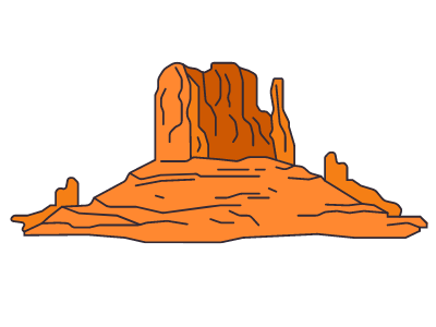
As far as road trips are concerned, Utah takes the cake. My favorite road trip in the United States was Utah’s Big 5 National Parks (overall through Laos takes the cake). I also highly recommend road-tripping Florida and California, while you’re at it. But if you’re looking to plan an epic Utah road trip that hits all the most scenic spots in the beehive state (why beehive? but now those beehives on their interstate signs make perfect sense), you’re in the right place.
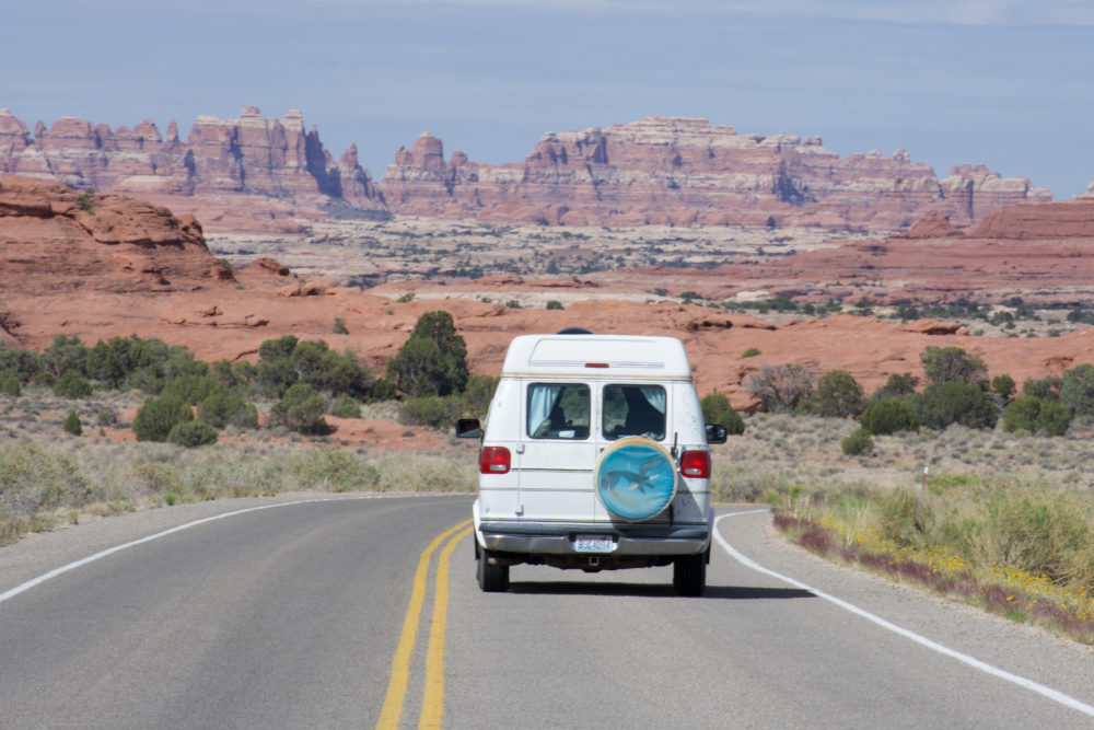
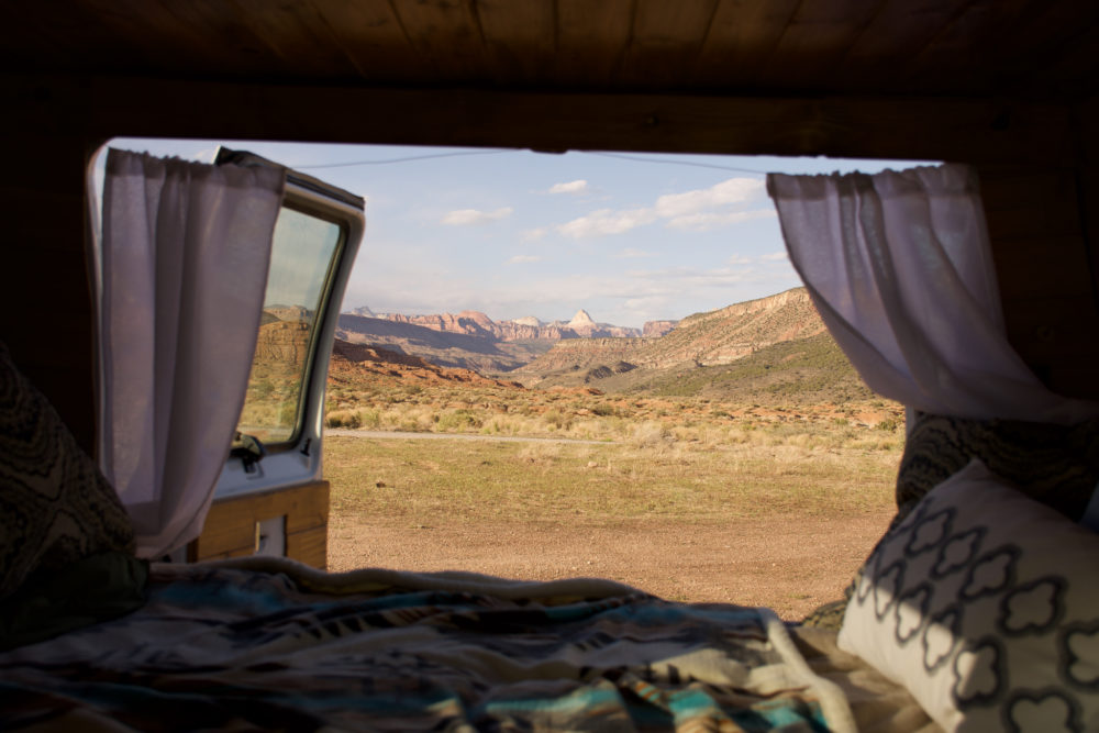
I’ve spent the better part of a year exploring the United States in my 1994 Dodge Ram Van named Phoebe. She’s taken me to some pretty incredible places. Utah wasn’t initially at the top of my travel list. All I knew was rocks and Mormons. But after spending some of the best nights of my road trip life in Utah, I’ve come away with a massive appreciation of the state.
Here’s everything you need to know to plan the perfect road trip through Utah.
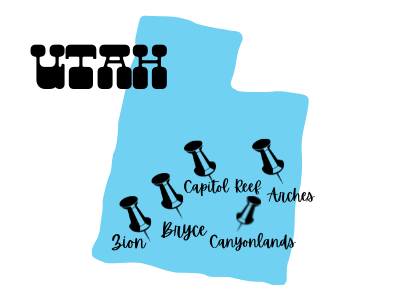
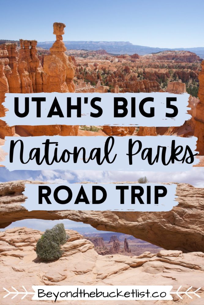
What are Utah’s Big 5 National Parks?
Aside from Alaska and California, Utah has the most National Parks. 3rd place isn’t too shabby for such a geographically small state. Those 5 national parks bring tourism from all over the world to Utah.
I’ll cover each park in-depth in the next few sections but these are the big 5 parks in Utah starting in the Southwest corner and moving Northeast.
- Zion National Park
- Bryce Canyon National Park
- Capitol Reef National Park
- Canyonlands National Park
- Arches National Park
Planning a Utah Road Trip
There are a few things you should know before you hit the road.
- Utah has weird alcohol laws. Like you can’t just have a beer at a bar. You always have to order food when consuming alcohol. You also won’t find many beers higher than 5% alcohol. The establishment must have a liquor license to sell beer with higher alcohol content.
- Utah does have a lot of very religious people. Let me preface this by saying, I’ve got nothing against normal religious people. But the ones that yell via megaphone that you’re a ‘Jezabel’ for wearing shorts and a crop-top on a 90-degree day at the gas station are the worst.
- You’ll rarely be alone. This is a popular tourist route. Although these towns are small and roadways cut through the desolate wilderness, there are loads of people around. Don’t come expecting the vast emptiness of Montana or Idaho.
- Free amenities are everywhere. From campground showers to water refill stations. Utah rarely makes you pay for the essentials.
- Scout out cheap gas ahead of time. I always use the app GasBuddy. Gas near the National Parks and in very remote areas will be most expensive.
- Research road conditions. Certain areas of Utah (even in National Parks) require a 4WD vehicle or high clearance.
Get the “America the Beautiful” National Parks Pass. This pass costs $80 and allows you to access every national park and monument for free for one year. (Well, not free, you paid $80). Since each park costs between $20-$35/car, if you plan on visiting three in one year it’s worth the cost. We used ours on our road trip around the USA to every national park in one year.
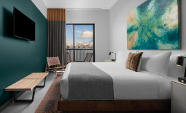
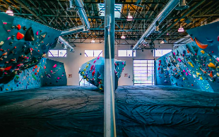
My Favorite Hotel in Utah
Evo Hotel (Salt Lake City)
Before you dive into the depths of Utah’s National Parks it could be a good idea to grab a shower. This Salt Lake City Hotel has super cozy rooms, a giant bouldering gym, and a skate park. In addition, to a lovely ski rental shop and great co-working spaces for us digital nomads. Evo is a brand recognized by all kinds of outdoor enthusiasts and their SLC location is perfectly situated next to the best pizza place in town. I highly recommend at least one overnight here. Don’t forget to grab breakfast at the Park Cafe while you’re at it!
When to Road Trip Utah’s National Parks
Spring is best and fall is a close second. Summer is scorching and winter can be brutal. Some love the weird eerie landscape of a snow-washed desert but I prefer a more mild climate suited to hiking.
Utah is primarily desert. Some of it is “high-desert”, yes, but that doesn’t make it any less freaking hot. We visited in May and the weather was honestly pretty ideal. The days were hot. Often reaching temperatures of near 90 degrees but the evenings were a pleasant 55. The reason late spring and early fall are preferred times of year is for the lack of snow and reasonable temperatures.
Flash Floods: Beware of visiting in early fall, however, as the “monsoon season” in the desert (July-September) can cause flash floods which are deadly in Utah’s iconic slot canyons and detrimental to van-dwellers camped in sandy BLM campgrounds. This is why we stuck to Spring.
How Long Should Your Utah Road Trip Be?
You could see all 5 national parks in one week.
I always hesitate when I tell people how long they should stay for because it’s entirely up to the traveler. You could cruise through all 5 in a weekend and see many of the iconic viewpoints. Not my travel style, but you do you. Or you could spend a month exploring every single hiking trail that each park offers.
These parks are also popular among bikers and climbers. If this is your jam then you may want to adjust the time frame to fit your itinerary because it will likely be vastly different than mine.
I recommend spending between 7-10 days to fully experience the highlights of each park including hiking some long trails.
Vanlife. The Best Utah Road Trip Experience.
It doesn’t get much easier than this.
Vanlife in the United States seems to be getting more and more difficult as towns grow tired of tourists trashing campsites and clogging up grocery store parking lots. When we first drove across the country in search of all America’s iconic eats, I hardly noticed the “No Camping” signs. Now they seem to be plastered on every pull-out and some towns have even banned car camping altogether.
But Utah loves van-dwellers. Or at least they have all the amenities that make life easy for us. Free water refill stations at every campground (whether or not you’re camping there), park visitor center, and even some grocery stores. Plenty of BLM land for free camping and private areas for showering.
In all 38 states we’ve road-tripped at this time, Utah has the most people living in vans.
Interested in Vanlife? Don’t yet have a van? I have an entire page where I talk about all things van life including the EASIEST way to convert your own van. You should also read my blog post covering the benefits of vanlife, how to survive vanlife with your partner, and the unglamorous reality of vanlife.
The Best Van Rental Company for Your Utah Road Trip
I highly recommend investing in a van for Utah. Fortunately for you, Traveller’s has cheap van rentals from Los Angeles, San Francisco, and Las Vegas. (All perfect places to start your Utah road trip from.) The best part?? You get unlimited free miles with your rental.
Or you can finally take the leap and convert your very own van. It doesn’t have to be expensive. (Here’s what we spent)
Looking for van rentals elsewhere? Check out RV Share or Escape Campervans.
Best BLM Campsites near Utah’s National Parks
Finding free camping is my forte. First, read my entire blog post dedicated to the art of stealth camping. Then forget it all for Utah. Ok, you still need most of it. BUT stealth camping is not as necessary in Utah because there is an abundance of BLM land that’s completely free.
BLM is short for the Bureau of Land Management. It’s essentially public land that has no designated use. Don’t go expecting any amenities. It doesn’t have restrooms or RV hookups. It’s typically just pull-outs or wide-open space with maybe some rocky self-constructed fire pits.
We’ve used BLM land everywhere (including for some epic sunrise hiking near Mount Rainier National Park). Utah is exceptionally scenic and highly traversed. Here’s a map of all the sites we used for Utah’s big 5 national parks.
If you want to guarantee a spot near the national parks be sure to arrive before sunset. Some of these spots get busy as they are so conveniently located.
BLM rules: PLEASE FOR THE LOVE OF ALL THAT IS GOOD READ THIS!! If we want to continue to have free access to this land we have to protect it. This means leave no trace. Always put out fires completely. Also, be kind to your neighbors. It’s standard practice to give each vehicle or tent a wide berth and not just jam into a small space with them.
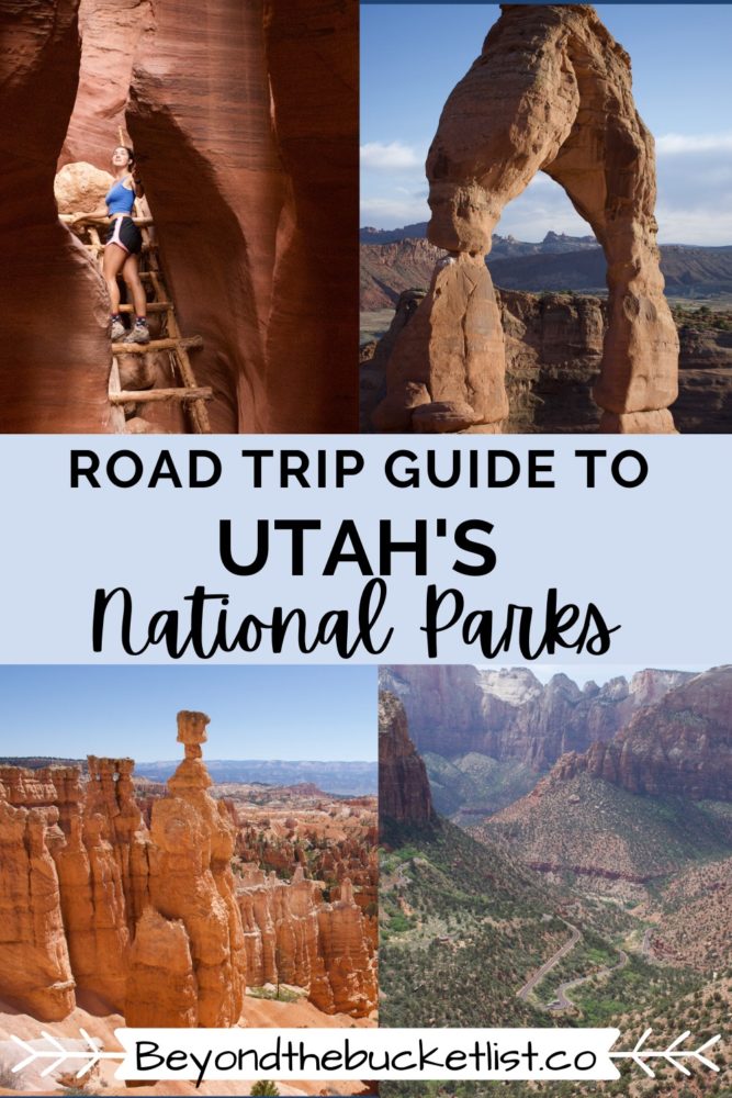
Zion National Park
Zion is the mighty Lion of Utah’s Big 5.
For those of you who aren’t wildlife lovers…the African Big 5 are Lions, Cape Buffalo, Elephants, Leopards, and Rhinocerous.
Zion is popular and for good reason. In fact, it’s the 3rd most visited park in the Unites States bringing in more than 4 million visitors per year. Fortunately, we visited the park while it was at 30% capacity during the 2020 pandemic.
Redish-orange sandstone monoliths circle a lush green valley with a pastel-blue river gushing through its center. Stand at any of the park’s high points and you’ll see why it draws so many visitors. It’s absolutely breathtaking. Like Yosemite in scale, but with a golden glow of desert rock.
Things No One Tells You About Zion National Park
1. Bring the Bike.
Bikes are a huge must in Zion. Parking is extremely limited and a portion of the national park (the one with ALL the trailheads) is only accessible via bike or shuttle. The road to reach the trailheads is only about 9-miles and completely flat. Not only can you get into the park earlier but you won’t be at the whim of the shuttle.
2. Speaking of the Shuttle…
To use the shuttle you can either park for free at the visitors center, or once that is full, pay $15 to park in the nearby town of Springdale. From Springdale, you take another free shuttle that connects to the main one. The visitor center fills up very early.
Getting back to the visitor center after a full day of activites can be annoying if relying on the shuttle. My hot tip is to ride up the canyon to the final stop (the narrows) & catch a bus from there back to the visitor center. Otherwise, you’ll wait for hours to get from stop 3 back down canyon to the visitor center.
COVID UPDATE: Because this is such a popular park during the COVID-era Zion closed the 9-mile scenic drive that accesses all the hiking trails to all vehicles except the shuttle. To nab a seat you have to book reservations a month in advance or at 5PM the day before when they release the last tickets. You can buy them here & tickets sell out at 5:03 PM so be ready.
3. Hike Early.
In a perfect world you would stay for 2 days and each morning at 6 AM start the day with a hike. This park is one of the most popular in the US and trails fill up early. Certain hikes like Angel’s Landing get more precarious and dangerous the more people attempt the climb.
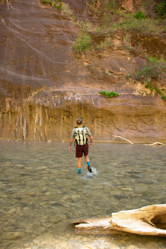
4. Bring AquaSocks
If you plan on hiking the Narrows (you should) you’re going to get wet. I wished I had water shoes for this one. Most of the hike is spent trekking through the running river. If you have balance issues I would grab a walking stick as well.
Hiking the Narrows: You don’t need waders. They cost $55 to rent from anywhere in town including the visitor center and if you’re visiting in Spring-Early Fall you don’t need them. It’s not that cold. Just plan to get wet and you’ll be fine. If you REALLY want to remain dry plan ahead and purchase your own waders from Amazon for cheaper.
5. Zion is Excellent in the Winter to Avoid Crowds
I recently just re-visited the park in January and the snow-dusted red rocks are incredible. All the trails (mostly) remain open and there is almost no one on the main drive. If you’ve ever been to Zion in the summer before you know how rare this can be.
Best Hikes in Zion National Park
I’m an avid hiker. But I don’t hike for no reason. I’m not peak-bagging. I’m looking for the most scenic hikes. It’s pretty much as simple as that. If the hike has some epic viewpoint at the summit or some noteworthy attractions along the way, I’m all in. All the hikes I recommend in the National Parks have that in common.
Angel’s Landing
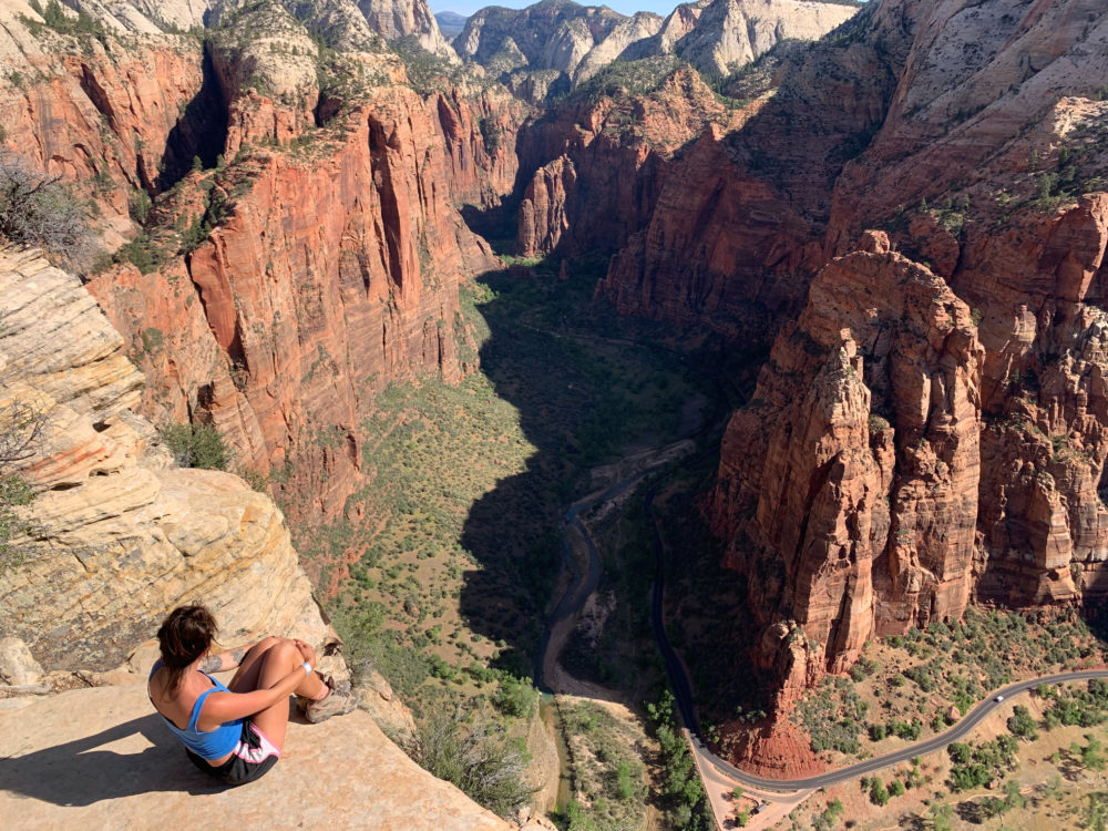
Without a doubt the most daring, exhilarating, and scenic hike in the park. Not overly strenuous in mileage this hike climbs the walls of the red rock canyon in a series of 25 switchbacks to Scout’s Lookout, also known as Wuss-out Point. From here you continue onto a 1.1-mile knife-edge climb up the spine of the mountain to the summit. The trail involves some climbing and is rimmed in metal chains to help guide you along the tricky parts.
Angels Landing Trail Info
Trail Length: 5.4 miles (out & back)
Prohibited: No dogs, No children under 12, No fear of heights
Permit Required!
Shuttle Stop: #6 The Grotto
2024 Update! Angel’s Landing now requires that you apply for a permit to hike to the summit from Scout’s Point. You can simply apply the day before to score a handful of the last-minute permits or the online reservation system starts 6 months in advance. Book your permits here.
The Narrows
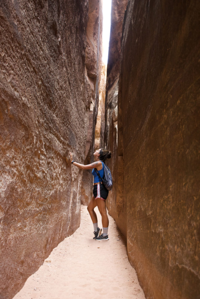
Frequently, voted one of the top 10 hikes in the world this hike is certainly scenic & unique. This is the other hike you should rise with the sun for. Begin by walking the 1-mile paved river walk to the banks of the pale blue Virgin River, then continue your hike upstream. At times, the water will be chest-deep depending on the time of year and the river’s flow rate. Force your way upstream and you’ll continue into a dark-walled slot canyon. This hike is really as long as you make it. Keep in mind it’s a lot easier coming back as you won’t be fighting the current.
Timing is everything. You can’t do this trek year-round. Flow rates on the river are extremely important and if the trail closes when conditions aren’t safe.
The Narrows Trail Info
Trail Length: 9 miles (out & back)
Prohibited: No dogs
Difficulty: Would be challenging for the elderly or hikers under 5ft.
Shuttle Stop: #9 Temple of Sinawava
Canyon Overlook

Truthfully, this is barely a hike. But you still have to do it. It’s one of the best views in all of Zion National Park. It’s only a 1-mile round trip and doable for all ages. At the summit, you’ll be overlooking winding switchbacks of highway through the center of Zion Valley. All while completely surrounded by Zion’s peaks.
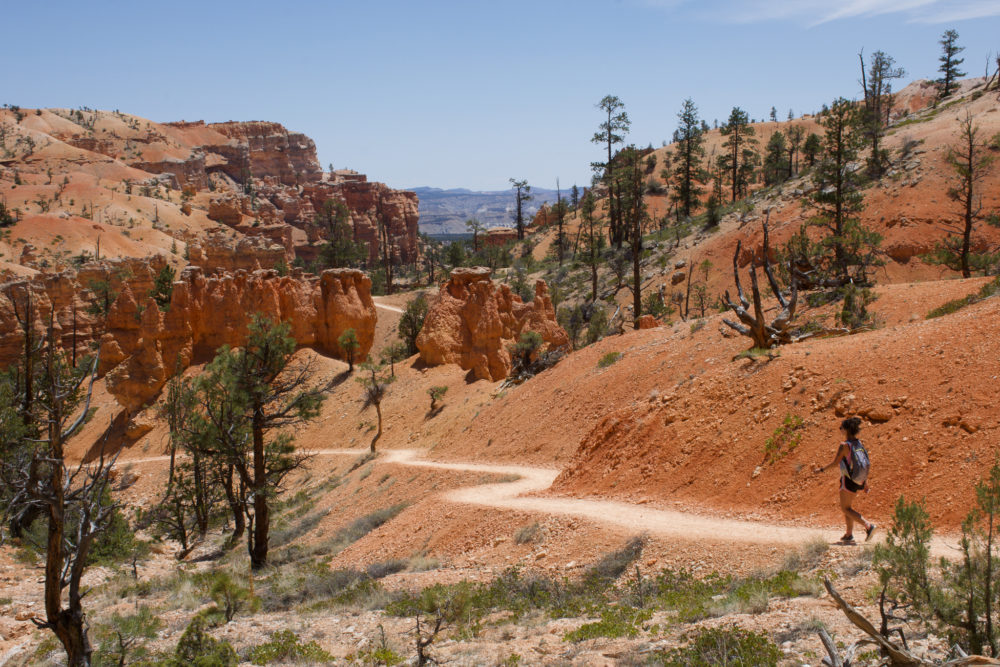
Bryce Canyon National Park
If we’re still using the African Big 5 analogy, Bryce is the Leopard. It sneaks under the radar of most tourists but in reality, it’s equally as breathtaking as Zion, just in a completely different way. That way is Hoodoos.
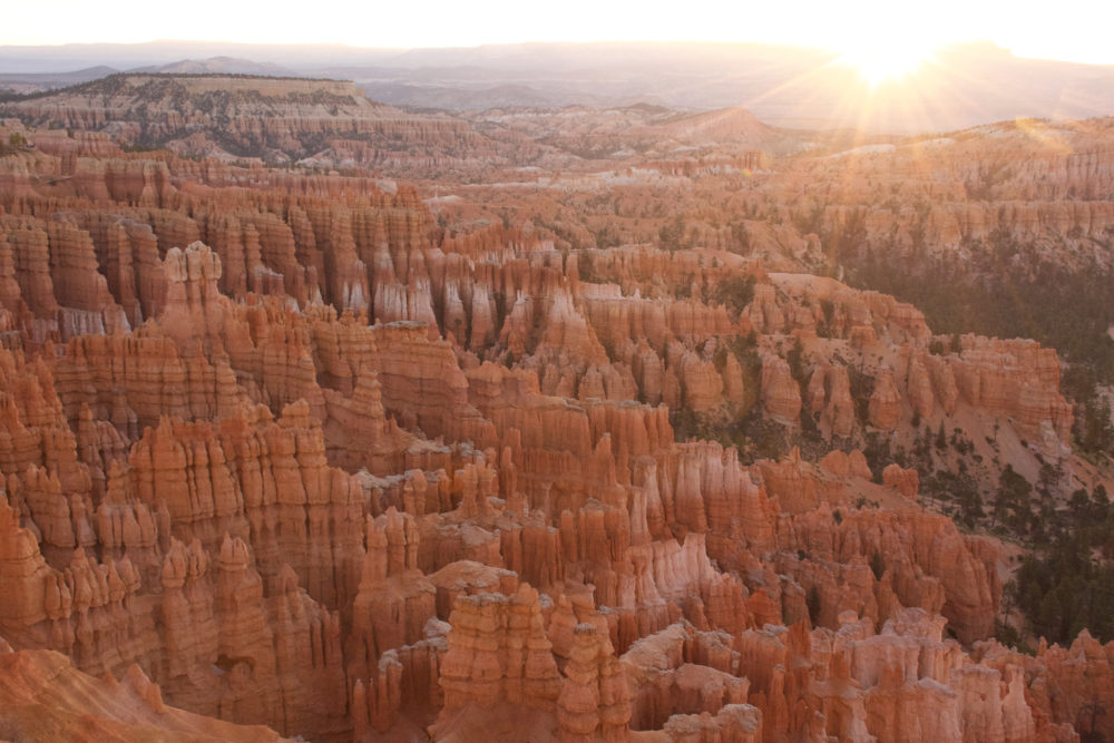
The same bright orange sandstone can be found in Bryce Canyon National Park that’s in the other parks but the formations are something completely out of this world. Slow erosion from frosty temperatures in the winter and pelting rain wear down the sandstone from sheer walls into gaping windows and then eventually these rounded spears pointing skyward. It’s a Dr. Seuss-like landscape.
Fun Fact About Trees: Bryce is also home to a 1,600-year-old Bristlecone Pine Tree. These weird scarred twisty trees only grow in 5 states with the oldest living tree currently dating back more than 4,000 years.
Things No One Tells You About Bryce Canyon National Park
1. Bryce sits at nearly 10,000 ft Elevation.
This means you need to leave time to acclimate. You’ll need to drink nearly twice as much water as you did at Zion and leave ample time to rest on hikes. It also gets much colder at night and stays cooler during the daytime in comparison to Utah’s other parks.
2. Contrary to what others say…it is a hiking park.
You can’t visit Bryce without suffering through at least one of its fairly strenuous hikes into the canyon. Despite this, the vast majority of its visitors only marvel at the viewpoints. Don’t be that visitor. Get into the canyon and get dirty.
3. You can stealth camp inside the park. (Ssshhhhhh)
Since Bryce Canyon is one of the least visited of the 5 Utah parks they aren’t as strict on overnight camping. Also, the park isn’t just one main road which makes policing parking lots a lot more difficult. Just find a secluded parking spot at an overlook and you should be fine.
4. Sunrise & Sunset Point are named poorly.
Sunrise point is not the best sunrise view by far. & Sunset point is actually best at sunrise. Why do they do this to us? Truthfully, there isn’t really a great place in Bryce for sunset. The canyon is positioned for the sunrise glow.
Must-See Sights in Bryce Canyon National Park
Bryce Viewpoint
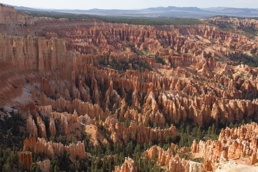
If you only stop at one lookout in Bryce Canyon National Park, make it this one. It’s an absolutely jaw-dropping view of a sea of hoodoos. Try to time your visit with either sunrise (when lighting at the park is best) or 4-6 PM when it’s painted in gold.
Inspiration Point
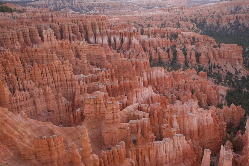
Another killer view. Totally worth the stop. We watched sunrise here & it was great.
Best Hikes in Bryce Canyon National Park
Fairyland Loop
This is the best hike in Bryce Canyon. It’s also one of the longest. It doesn’t have a huge change in elevation and takes you through most of the varied scenery in the national park.
Fairyland Loop Trail Info
Trail Length: 8 miles (Loop)
Elevation: 1,545 ft.
Prohibited: No dogs
Tips: Start hike early. Bring lots of water.
Peekaboo Canyon is beautiful. But if you only have the time and energy for one hike…make sure it’s the Fairyland Loop. Peekaboo is famous for its window-like structures in the canyon walls.
Peekaboo Loop Trail Info
Trail Length: 5.4 mile (Loop)
Elevation: 1,450 ft.
Prohibited: No Dogs
Tips: More strenuous than you think. It’s a lot of switchbacks and up and down for such a short hike.
Capitol Reef National Park
Ah, the good ol’ Cape Buffalo. No one gives much of a fuss about it but arguably, this is what makes this Utah park so great. Red rock cliffs, slot canyons, arches, it’s got a little bit of everything but far fewer people than any of the other National Parks in Utah.
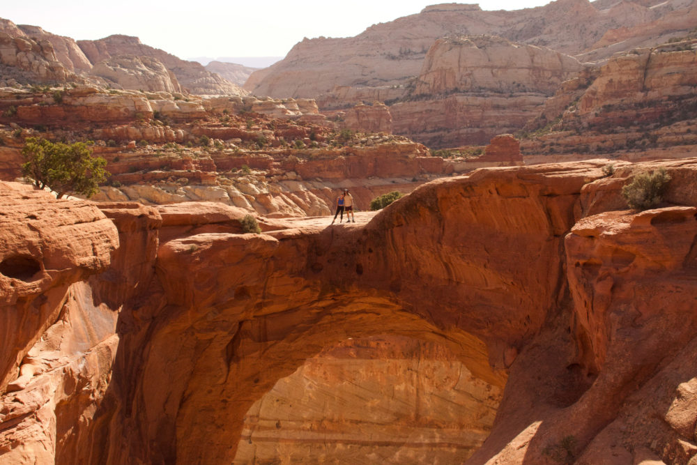
Is it my favorite…no.
But it has the most scenic BLM camping, some really beautiful hikes, and the feeling of remoteness you crave when you’re venturing into the great outdoors.
Things No One Tells You About Capitol Reef National Park
1. It’s (kind of) free?
Unlike the other national parks in Utah, there is no ticket booth here. Technically, I think it’s $20 to enter but there were no booths checking passes or selling tickets. If you took my advice and bought the America the Beautiful Pass, it doesn’t pertain to you anyways.
2. It’s surprisingly pretty.
Maybe me comparing this park to a Cape Buffalo doesn’t do it justice. It’s shockingly pretty. I think because no one ever talks about it I had very low expectations but despite spending the entire last week rolling in red rock I wasn’t bored of the scenery here.
3. This area of Utah is a food desert.
This means that the local residents are forced to do all their grocery shopping at small general stores and gas stations. Across about a 150-mile stretch of highway, there isn’t a single ‘regular’ grocery store.
For the residents, this severely limits the quality and diversity of the food they are privy to. For us travelers, this means you have to stock up before you spend time in the area or be prepared to worth with what they’ve got.
If you have food restrictions or allergies this can be extra challenging. Expect the shelves to be filled with processed food, canned or boxed goods, and very little fresh produce.
4. If you’re looking for free amenities check out Fruita Campground.
Located in the middle of the park this little grassy haven has water, restrooms, and a few day-use areas if you are seeking some shade.
Best Hikes in Capitol Reef National Park
I’ve got one must-do hike for you in the park. If you’re interested in backcountry hiking there is a lot more you can do here but this one trail, in particular, is a must-do.
Cassidy Arch Trail Info
Trail Length: 3.1 Miles
Elevation: 666 ft.
Prohibited: No Dogs
Trail Tips: No shade & should be done as early as possible in the day (start before 8 AM).
Grand Wash Trail? This trail is only about 2 miles round-trip but it’s rather underwhelming. If you’ve seen slot canyons before…this won’t be impressive. Skip it & spend your time elsewhere.
Arches National Park
My metaphor runs a little thin here, but I’ll try. This is the Rhino of Utah’s national parks. A favorite, for sure, but also at risk of being lost forever. The iconic arches of the park are slowly worn away by the elements and probably the tourist impact.
This park was just arch after arch after arch. It seems like every hike has 3 or 4 scenic arches you have to see. I’ll be honest, I was over the arches after one hike. They all look so similar do I need to see 10 of them?? Maybe it was red rock burn out, after 3 other desert parks and 2 weeks in Utah I was no longer in awe of the landscape.
I’ll share with you the hikes that really knocked my socks off during my visit.
Things No One Tells You About Arches National Park
Arches is popular. Probably, because it’s so close to Moab. Probably, because you’ve seen photos 100,000 times on Instagram. Even Utah’s license plate features Arches National Park. It’s just a busy place. Even waking up to hike at 7 AM we found the parking lots at the trailhead mostly full.
2. Hikes here are short but draining.
Many of the seemingly easy short hikes in the park involve rock scrambles, hills, and traversing sand paths. They are also 100% exposed to the elements. This makes a 1-3 mile hike much more time-consuming and strenuous especially if you’re attempting it in the desert heat.
3. They stop selling tickets at 5 PM. Which creates a huge line.
Even if you have your parks pass handy, there is only one way into Arches. & right before the 5 PM cut off the line to get into the park is astronomical. Time your entry for sunset around this line and don’t even bother heading in until 6 PM.
4. This is THE national park for Astrophotography.
This entire area of Utah is dark skies certified. Pair that with the photographic foreground of arches and crimson rock cast in blue light and you’ve got yourself the perfect pair for dramatic nighttime photos. Check for clear skies and the new moon for the best nighttime shots.
Best Hikes in Arches National Park
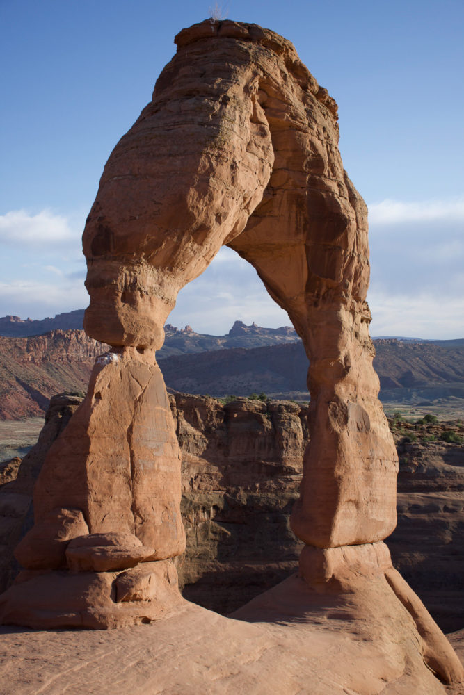
Delicate Arch
This hike is totally worth the hype. Shoot for sunset and you’ll be rewarded with absolutely stunning views. You’ll have to share it with many others but I promise it’s one of those rare tourist attractions that’s completely worth it.
Delicate Arch Trail Info

Trail Length: 3.2 miles (out & back)
Elevation: 629 ft.
Prohibited: No Dogs
Trail Tips: It’s completely exposed so it’s best to either do it early or go for sunset.
Double O Arch via Primitive Loop
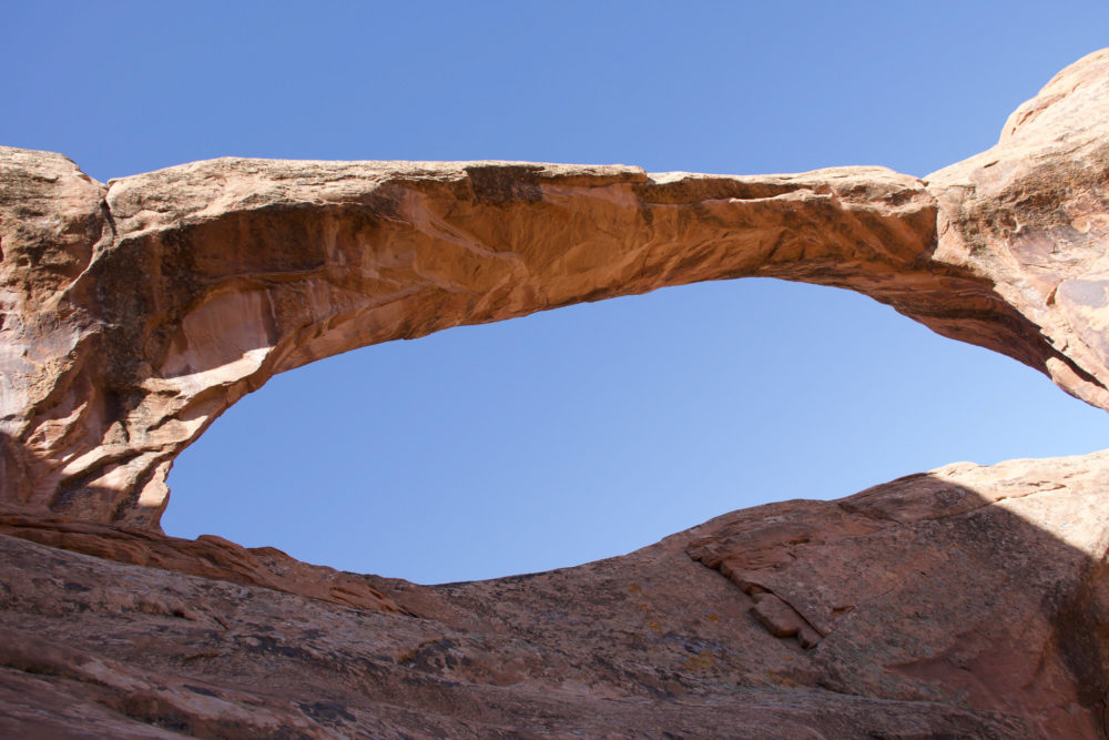
These are the only other arches worth trekking for. I loved walking over the tops of the smooth desert rock.
Double O Arch Trail Info

Trail Length: 7.4-mile Loop
Elevation: 450 ft
Trail Tips: Completely exposed and very hot if you don’t hit it early in the day. The trail is also made of loose sand so it takes longer than anticipated.
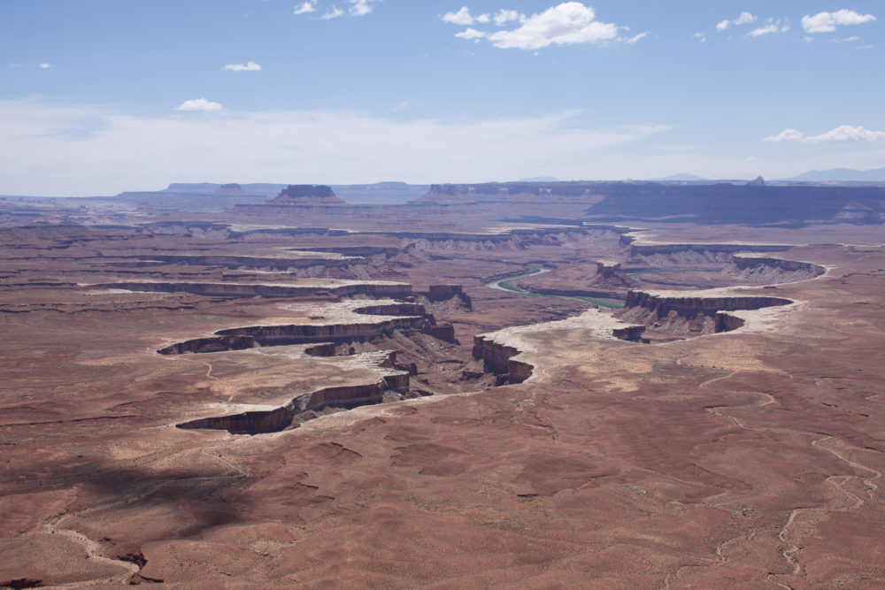
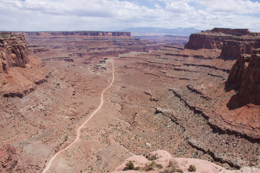
Canyonlands National Park
Last but certainly not least we have the grand and mighty Elephant. Not just because this national park is immense but because the more you learn about this rugged wilderness the more you love it.
It’s like the Grand Canyon but just a little less grand. You’ll stand on the edge of the earth overlooking a desolate brown canyon snaked with curving roads and the jagged edges of yet another canyon. It’s like a canyon within a canyon. Canyon inception.
Things No One Tells You About Canyonlands National Park
1. It’s actually 3 mini national parks.
This humongous park is actually divided into three distinct sections. You can’t easily reach one section from another. It’s best to plan your trip with a focus on one or two of the sections.
Island in the Sky Region.
This is the most popular section. Easily accessible and dotted with scenic overlooks it’s the least adventurous but most dramatic of the three regions. It’s also the closest to the town of Moab where you’ll likely be spending some time. We visited this region.
White Rim or The Maze Region.
Quite possibly the coolest part of Canyonlands, this is the unpaved dirt roads that take you into and through the canyon itself. It requires an overnight permit (because it takes 2 days to drive the route) and a 4X4 vehicle with high clearance. Unfortunately, we didn’t get to explore this part of the park.
The Needles Region.
Where the hikers come to play. About an hour south of Moab, this region is my personal favorite. Needles offers jaw-dropping panoramic views of weirdly shaped orange rock formations, arches, and slot canyons. It’s highly underrated and has ALL the best hikes in Canyonlands National Park.
2. It is a hiking park.
Much like Bryce Canyon people blow through the Island in the Sky portion of Canyonlands and never venture far from their vehicle. But there are actually tons of scenic hikes throughout the canyon and along the rim. & Needles region is known for its double-digit treks.
Don’t visit without doing at least one desert day-trip. I’ll lay out my favorites below.
3. Having a 4WD vehicle makes all the difference.
This park has TONS of scenic roads that require 4WD. If you don’t have it you’ll miss out on major portions of the park.
The town of Moab: It’s a bit of a zoo. Moab is a bustling epicenter of dirt-bag climbers, screaming dune buggies, Olympic-fitness biking families, and a plethora of other outdoor adventurers. It’s also got the typical national park-hopping tourists. It’s neat for meeting fellow travelers and the longer you stay the more it grows on you. There is a great park for vanlifers to hang out at during the day and the Moab Brewery cooks up a mean burger. If you’re in need of killer Mexican cuisine or a cool refreshing Hawaiian Ice check out the Moab food truck market.
Must-See Sights in Canyonlands National Park
Grand View Overlook (Island in the Sky)
It truly is grand. One of the better viewpoints of the canyon within the canyon. Also an incredible spot to watch sunset.
Green River Overlook (Island in the Sky)
This viewpoint is aptly named. It’s a view of the Green River as it rushes through the canyon. Visit in Spring and the river banks will indeed be lush and green. Also, another good spot for sunset.
Shafer Canyon Overlook (Island in the Sky)
Welcoming you to the park, this overlook offers a more varied landscape and a picture-perfect panoramic point.

Best Hikes in Canyonlands National Park
Mesa Arch (Island in the Sky)
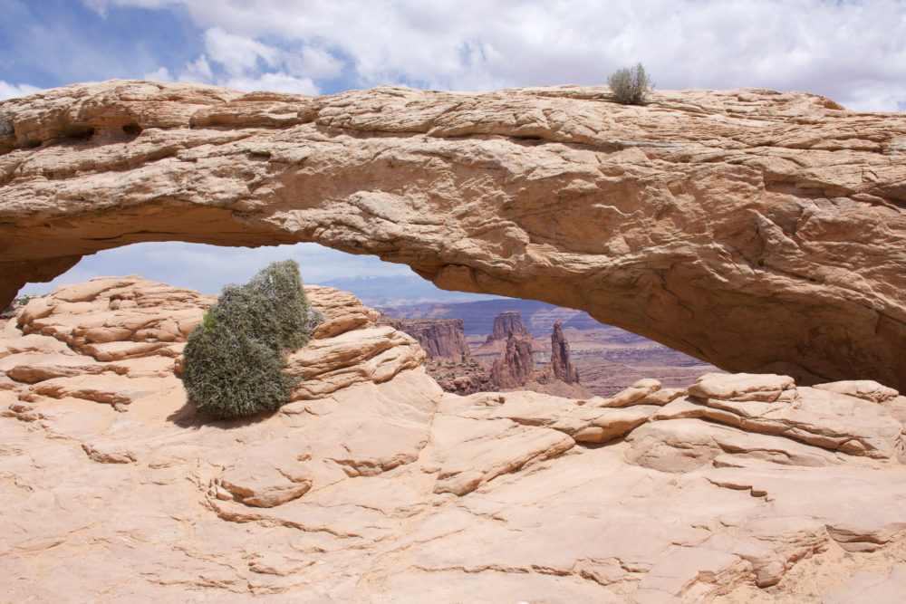
This is really more of a walk. It’s only .5 miles (round-trip) from the parking lot so I’m not even going to include trail stats BUT it’s worth the visit. Reminiscent of Arches National Park this curved arch is noteworthy because of the stunning snow-capped mountains and canyon in the backdrop. This is an ideal location to watch the sunrise if that’s your kind of thing.
Chesler Park Loop – Elephant Hill to Joint Trail (Needles)
This hike made me fall in love with the needles. & also hate it at the same time. It’s pretty strenuous. It reminded me of the time we climbed Adam’s Peak in Sri Lanka, constantly climbing. I underestimated how much water we would need.
But if you can power through the entire loop you’ll be rewarded with killer views and a really neat slot canyon experience. It’s also a remote hike so you won’t have to contend with a lot of other hikers.
Chesler Park Loop Trail Info
Trail Length: 11.2-mile loop
Elevation: 1700-1800 ft.
Trail Tips: This hike is long. & fully exposed. Bring LOTS of water and be prepared to follow the cairns to keep on track.
Druid Arch (Needles)
We didn’t make it to Druid arch but some locals who had hiked every single park trail multiple times said this was their favorite. If we return we plan to give this one a go.
Druid Arch Trail Info

Trail Length: 10.4 (out & back)
Elevation: 1000+ ft.
Trail Tips: Another very exposed desert hike. Bring lots of water.
More Noteworthy Destinations to Add to Your Utah Road Trip
Not all Utah has to offer is in its national parks. Utah has slot canyons, gushing swimmable waterfalls, and hundreds of miles of untamed wilderness for truly intrepid travelers. We found a few other destinations along our route (the most common route) through Utah that you could easily add to your Utah road trip.
We didn’t venture to the Northern half of the state. I’m sure there are some amazing attractions up near Salt Lake City and once we visit I’ll be sure to add them here.
But for now….
Grand Staircase Escalante
This national monument might just be cooler than all the national parks combined. For starters, it’s huge. It’s also very secretive. Locals keep the best slot canyons and rock formations to themselves leaving you to explore the Mars-like terrain on your own. It’s a rare slice of wilderness left in the world.
You can camp freely throughout and hike for days into the depths of the raw rugged desert. When we return to Utah we plan to spend a significant amount of time getting to know Grand Staircase Escalante.
The only downside is that you require a 4WD vehicle with high-clearance to make it to most of the impressive sights.
Kanarra Falls
As of 2019, you need a permit to hike the falls.
This means you’ll need to reserve a spot far in advance if you plan on visiting in the popular Spring months. Check availability on this website here.
Lower Calf Creek Falls
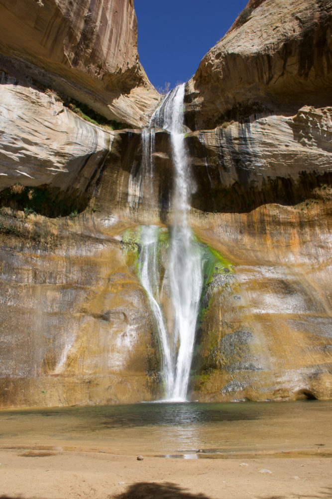
Another less exclusive waterfall that’s perfect for a mid-day dip. If you have the misfortune of hiking this 6.2-mile sandy loop mid-day like we did (whoops) the trail is sweltering. But it’s relatively flat and the waterfall is an ice-cold oasis. Well-worth your time for a quick dip.
Your Utah Road Trip Map
Here’s a map of all the destinations we discussed in this guide to get you started.
Want More Road Trip Ideas? Sign up for our newsletter & we will send you our entire USA road trip Google map with 400+ worthwhile attractions and destinations. I promise I won’t spam your inbox.
Have more Utah or Vanlife related questions? Feel free to shoot me an email at geena.truman@gmail.com or a message on Instagram @beyond_the_bucketlist anytime. But for now, you’re all set for a Utah road trip.
Get ready for Life Elevated. It’s a Utah thing.
Just found you!!! So helpful!
Thanks!